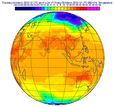
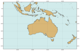
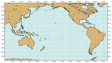
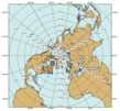
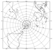
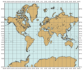
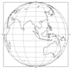
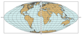
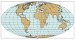
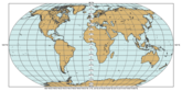
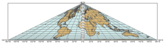
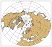
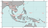
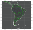
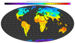
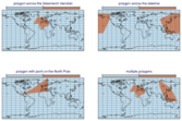
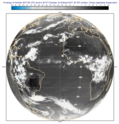
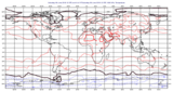
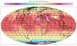
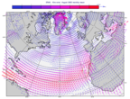
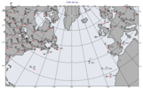
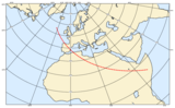
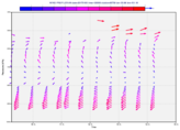
metview Logo

Examples

  • Gallery
  • Notebooks

Documentation

  • Overview
  • Using Metview
  • Python API
  • Macro language
  • Resources
  • Tutorials
  • Frequently asked questions

Installation

  • Installation
  • Build
  • Release notes
  • Licence
metview
  • Gallery
  • View page source

Gallery

Map projections

These examples feature various map projections.
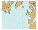
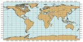
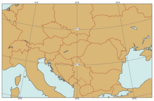
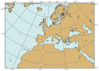
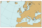
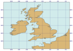
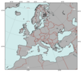
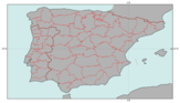
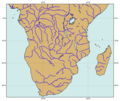
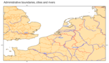
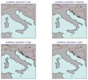
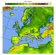
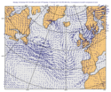
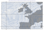
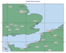
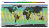
Predefined Areas

Predefined Areas

Cylindrical Projection

Cylindrical Projection

Cylindrical Projection on Subarea

Cylindrical Projection on Subarea

Cylindrical Projection across the Dateline

Cylindrical Projection across the Dateline

North Polar Stereographic Projection

North Polar Stereographic Projection

South Polar Stereographic Projection

South Polar Stereographic Projection

Polar Stereographic Projection Defined by Centre and Scale

Polar Stereographic Projection Defined by Centre and Scale

Mercator Projection

Mercator Projection

Lambert Projection on Subarea

Lambert Projection on Subarea

Geos Projection

Geos Projection

Tilted Perspective Projection

Tilted Perspective Projection

Goode Projection

Goode Projection

Mollweide projection

Mollweide projection

Robinson Projection

Robinson Projection

Bonne Projection

Bonne Projection

Bonne Projection on Subarea

Bonne Projection on Subarea

Collignon projection

Collignon projection

EPSG:3035 Projection

EPSG:3035 Projection

Coastlines

These examples feature coastlines settings.

Map Grid Lines and Grid Labels

Map Grid Lines and Grid Labels

Political Boundaries

Political Boundaries

Administrative Boundaries

Administrative Boundaries

Rivers

Rivers

Capital Cities

Capital Cities

Boundaries, Cities and Rivers

Boundaries, Cities and Rivers

Custom Shapefile Map Layer with Major River Basins

Custom Shapefile Map Layer with Major River Basins

Coastlines Resolutions

Coastlines Resolutions

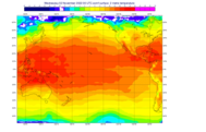
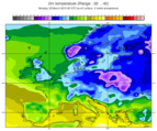
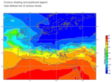
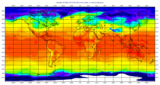
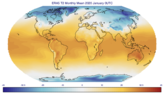
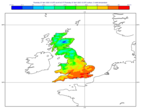
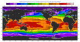
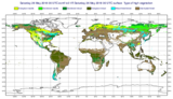
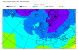
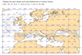
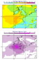
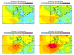
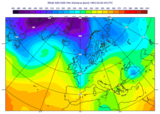
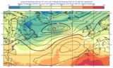
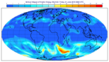
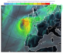
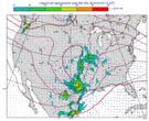
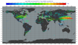
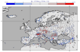
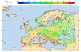
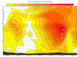
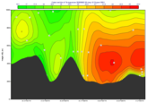
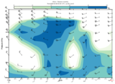
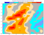
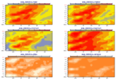
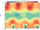
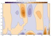
Gridded scalar data on map

These examples feature map plots with gridded scalar data.

GRIB - Interval Shading Contour

GRIB - Interval Shading Contour

GRIB - Contour Shading and Positional Legend

GRIB - Contour Shading and Positional Legend

GRIB - Dynamic Contour Shading Palette

GRIB - Dynamic Contour Shading Palette

GRIB - 2m Temperature with ecCharts Style

GRIB - 2m Temperature with ecCharts Style

GRIB - Field Anomalies

GRIB - Field Anomalies

GRIB - Layout with 3 Maps

GRIB - Layout with 3 Maps

GRIB - Contouring with Gradient Shading

GRIB - Contouring with Gradient Shading

GRIB - Contour Shading Only Over Land

GRIB - Contour Shading Only Over Land

GRIB - EFI Map with Marker Shading

GRIB - EFI Map with Marker Shading

GRIB - Model Orography with Land Sea Mask

GRIB - Model Orography with Land Sea Mask

GRIB - Masking

GRIB - Masking

GRIB - Frame Masking

GRIB - Frame Masking

GRIB - Polygon Masking

GRIB - Polygon Masking

GRIB - Shapefile Masking

GRIB - Shapefile Masking

GRIB - De-accumulate Precipitation Forecast

GRIB - De-accumulate Precipitation Forecast

GRIB - Simulated Satellite Image

GRIB - Simulated Satellite Image

GRIB - SST on Extended Cylindrical Map

GRIB - SST on Extended Cylindrical Map

GRIB - ERA5 SST El Nino Maps

GRIB - ERA5 SST El Nino Maps

GRIB - Map with Zonal Mean Curve

GRIB - Map with Zonal Mean Curve

GRIB - High Vegetation Type ERA5

GRIB - High Vegetation Type ERA5

GRIB - Low Vegetation Type with Column Legend ERA5

GRIB - Low Vegetation Type with Column Legend ERA5

GRIB -  Categorical Wind Direction

GRIB - Categorical Wind Direction

GRIB - Histogram Legend

GRIB - Histogram Legend

GRIB - Disjoint Legend

GRIB - Disjoint Legend

GRIB - Forecast Steps

GRIB - Forecast Steps

GRIB - Forecast Steps with Shared Title

GRIB - Forecast Steps with Shared Title

GRIB - Forecast Steps with Shared Legend and Title

GRIB - Forecast Steps with Shared Legend and Title

GRIB - Grid Values and Contour Levels

GRIB - Grid Values and Contour Levels

GRIB - Temperature Below 0 Celsius

GRIB - Temperature Below 0 Celsius

GRIB - Difference Plot with Rainbow Contour Settings

GRIB - Difference Plot with Rainbow Contour Settings

GRIB - Split contouring

GRIB - Split contouring

NetCDF - Temperature

NetCDF - Temperature

NetCDF - Ozone Layout 2x2

NetCDF - Ozone Layout 2x2

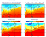
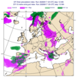
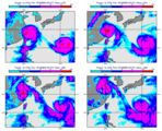
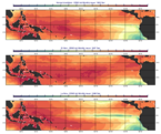
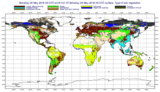
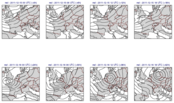
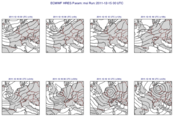
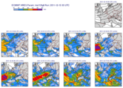
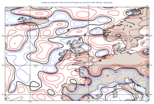
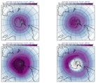
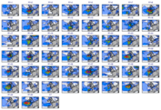
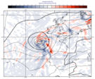
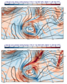
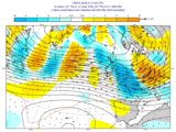
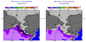
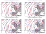
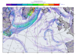
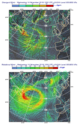
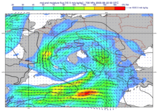
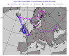
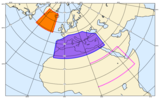
Ensemble data on map

These examples feature map plots with ensemble forecast data.

GRIB - ENS Mean and Spread

GRIB - ENS Mean and Spread

GRIB - ENS Windgust Probability

GRIB - ENS Windgust Probability

GRIB - ENS Windgust Percentile

GRIB - ENS Windgust Percentile

GRIB - ENS Stamp Map

GRIB - ENS Stamp Map

GRIB - ENS Stamp Map with Shared Legend and Title

GRIB - ENS Stamp Map with Shared Legend and Title

GRIB - ENS Spaghetti Map

GRIB - ENS Spaghetti Map

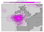
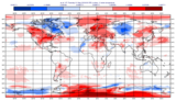
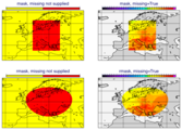
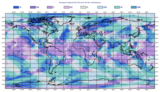
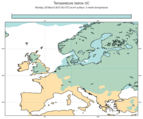
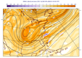
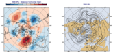
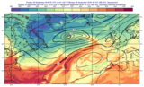
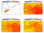
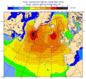
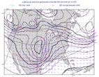
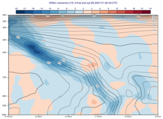
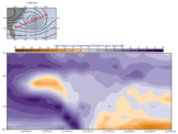
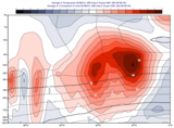
Computed scalar data on map

These examples feature some computations resulting in gridded scalar data.
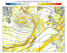
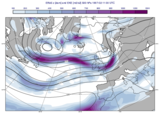
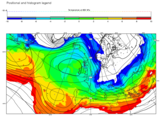
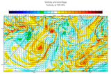
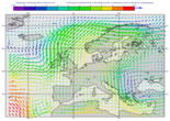
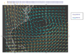
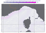
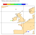
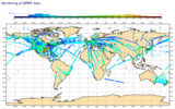
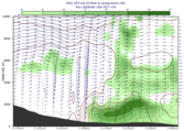
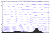
GRIB - Humidity advection

GRIB - Humidity advection

GRIB - Absolute Vorticity

GRIB - Absolute Vorticity

GRIB - 500/1000 hPa Thickness

GRIB - 500/1000 hPa Thickness

GRIB - Thermal Front Parameter

GRIB - Thermal Front Parameter

GRIB - Deformation

GRIB - Deformation

GRIB - Departure from zonal mean

GRIB - Departure from zonal mean

GRIB - Eddy Kinetic Energy

GRIB - Eddy Kinetic Energy

GRIB - Static Stability

GRIB - Static Stability

GRIB - Q-vector

GRIB - Q-vector

GRIB - Potential Temperature

GRIB - Potential Temperature

GRIB - Equivalent Potential Temperature

GRIB - Equivalent Potential Temperature

GRIB - SST Mean with Missing Values

GRIB - SST Mean with Missing Values

GRIB - Vertical Integral

GRIB - Vertical Integral

GRIB - Gaussian Smoothing

GRIB - Gaussian Smoothing

GRIB - Pressure to height level interpolation

GRIB - Pressure to height level interpolation

Vector data on map

These examples feature map plots with vector data.
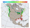
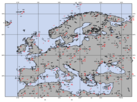
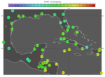
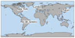
GRIB - Vorticity and Wind

GRIB - Vorticity and Wind

GRIB - Wind Coloured by Temperature

GRIB - Wind Coloured by Temperature

GRIB - Temperature Gradient Vectors

GRIB - Temperature Gradient Vectors

GRIB - Coloured Wind Vectors

GRIB - Coloured Wind Vectors

GRIB - Mean Wave Direction and Significant Wave Height

GRIB - Mean Wave Direction and Significant Wave Height

GRIB - Wind Field Overlay and Legend Box

GRIB - Wind Field Overlay and Legend Box

GRIB - Derive Wind from Spectral Divergence and Vorticity

GRIB - Derive Wind from Spectral Divergence and Vorticity

GRIB - Derive Divergent and Rotational Wind from Spectral Divergence and Vorticity

GRIB - Derive Divergent and Rotational Wind from Spectral Divergence and Vorticity

GRIB - Geostrophic Wind Overlay

GRIB - Geostrophic Wind Overlay

GRIB - Ageostrophic Wind

GRIB - Ageostrophic Wind

GRIB - Thermal Wind

GRIB - Thermal Wind

GRIB - Moisture Flux

GRIB - Moisture Flux

GRIB - Windgust and MSLP with 10m Wind

GRIB - Windgust and MSLP with 10m Wind

GRIB - Streamlines

GRIB - Streamlines

NetCDF - Wind

NetCDF - Wind

NetCDF - Sea Currents with Fix-sized Vectors

NetCDF - Sea Currents with Fix-sized Vectors

ODB - TEMP Wind

ODB - TEMP Wind

Wind Vectors from List Data

Wind Vectors from List Data

Point data on map

These examples feature map plots with point data.

NetCDF - Marine Observations

NetCDF - Marine Observations

GRIB, BUFR - Model minus Obs Difference

GRIB, BUFR - Model minus Obs Difference

BUFR - SYNOP Map

BUFR - SYNOP Map

BUFR - Plotting SYNOP Station Ids

BUFR - Plotting SYNOP Station Ids

BUFR - TEMP Map

BUFR - TEMP Map

BUFR, Geopoints - Coloured Observation Values

BUFR, Geopoints - Coloured Observation Values

BUFR, Geopoints - Coloured Observation Values in Circles

BUFR, Geopoints - Coloured Observation Values in Circles

ODB - AMSU-A Radiance Map

ODB - AMSU-A Radiance Map

Geopoints - Aircraft observations

Geopoints - Aircraft observations

Geopoints - Missing Values in Geopoints

Geopoints - Missing Values in Geopoints

Geopoints - Plot Text Labels at Geopoints Locations

Geopoints - Plot Text Labels at Geopoints Locations

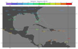
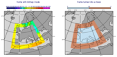
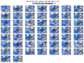
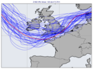
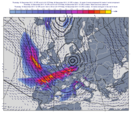
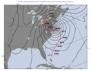
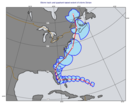
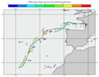
Tracks and curves on map

These examples feature map plots with tracks, curves and shapes.

GRIB, CSV - Storm Track

GRIB, CSV - Storm Track

CSV - Storm Wind Quadrants

CSV - Storm Wind Quadrants

GRIB - ERA5 Data Along Ship Track

GRIB - ERA5 Data Along Ship Track

FLEXTRA - Forward Trajectories

FLEXTRA - Forward Trajectories

Geoline on Map

Geoline on Map

Geopolyline on Map

Geopolyline on Map

Geocircle on Map

Geocircle on Map

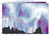
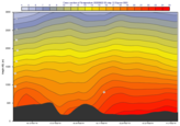
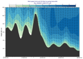
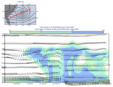
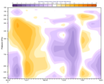
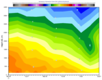
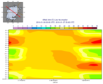
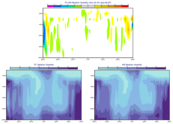
Vertical cross sections

These examples feature vertical cross sections.
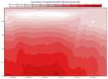
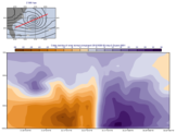
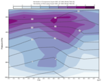
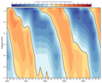
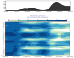
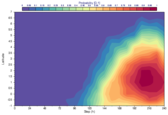
Cross Section for Pressure Level Data

Cross Section for Pressure Level Data

GRIB - Cross Section for Temperature Advection ERA5

GRIB - Cross Section for Temperature Advection ERA5

Cross Section for Model Level Data with Orography

Cross Section for Model Level Data with Orography

Cross Section with Orography and Boundary Layer Height

Cross Section with Orography and Boundary Layer Height

Cross Section in Height for Model Level Data with Orography

Cross Section in Height for Model Level Data with Orography

Cross Section in Height for Pressure Level Data with Orography

Cross Section in Height for Pressure Level Data with Orography

Cross Section 3D Wind in Height for Model Level Data

Cross Section 3D Wind in Height for Model Level Data

Cross Section Wind Speed and 3D Wind in Height for Model Level Data

Cross Section Wind Speed and 3D Wind in Height for Model Level Data

Cross Section Going Through the South Pole

Cross Section Going Through the South Pole

Cross Section Normal Wind Component with Map

Cross Section Normal Wind Component with Map

Cross Section Parallel Wind Component with Map

Cross Section Parallel Wind Component with Map

Cross Section Unprojected Wind and Relative Humidity with Map

Cross Section Unprojected Wind and Relative Humidity with Map

Cross Section 3D Parallel Wind

Cross Section 3D Parallel Wind

Hovmoeller diagrams

These examples feature Hovmoeller diagrams.
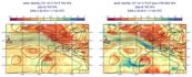
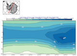
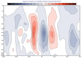
GRIB - Time-height Section Hovmoeller

GRIB - Time-height Section Hovmoeller

GRIB - Time Height Section Hovmoeller with Wind and Humidity

GRIB - Time Height Section Hovmoeller with Wind and Humidity

GRIB - ERA5 Quasi Biennial Oscillation on Vertical Hovmoeller

GRIB - ERA5 Quasi Biennial Oscillation on Vertical Hovmoeller

GRIB - Vertical Hovmoeller in Pressure with Model Level Data

GRIB - Vertical Hovmoeller in Pressure with Model Level Data

GRIB - Vertical Hovmoeller in Height with Model Level Data

GRIB - Vertical Hovmoeller in Height with Model Level Data

GRIB - Hovmoeller Area Average

GRIB - Hovmoeller Area Average

GRIB - Hovmoeller Area Statistics

GRIB - Hovmoeller Area Statistics

GRIB - ERA5 Ozone Latitude Hovmoeller

GRIB - ERA5 Ozone Latitude Hovmoeller

GRIB - Line Hovmoeller T850 ERA5

GRIB - Line Hovmoeller T850 ERA5

GRIB - Line Hovmoeller with Map T2 from ERA5

GRIB - Line Hovmoeller with Map T2 from ERA5

GRIB - Line Hovmoeller with Orography ERA5

GRIB - Line Hovmoeller with Orography ERA5

Average sections

These examples feature average vertical sections.

GRIB - Zonal Average

GRIB - Zonal Average

GRIB - Temporal Zonal Average of ERA5 V Wind Component

GRIB - Temporal Zonal Average of ERA5 V Wind Component

GRIB - Zonal Average Difference

GRIB - Zonal Average Difference

GRIB - Meridional Average

GRIB - Meridional Average

Vertical profiles

These examples feature vertical profiles.

GRIB - ERA5 Ozone Profile

GRIB - ERA5 Ozone Profile

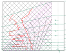
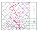
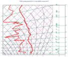
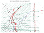
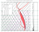
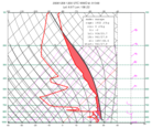
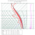
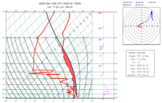
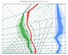
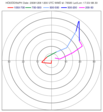
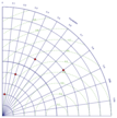
Thermodynamic diagrams

These examples feature thermodynamic diagrams (tephigram and skew-t) and hodographs.
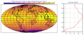
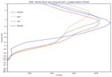
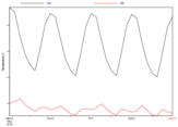
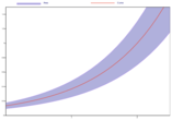
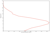
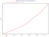
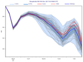
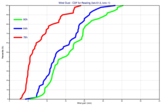
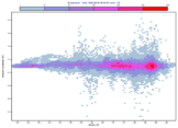
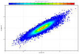
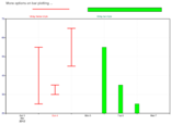
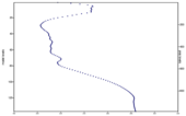
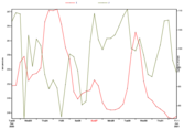
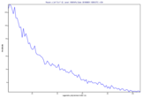
Tephigram from List Data

Tephigram from List Data

BUFR - Tephigram

BUFR - Tephigram

ODB - Tephigram

ODB - Tephigram

GRIB, BUFR - Forecast and Observation on Tephigram

GRIB, BUFR - Forecast and Observation on Tephigram

GRIB - Parcel Path from Surface on Tephigram

GRIB - Parcel Path from Surface on Tephigram

GRIB - Parcel with Maximum CAPE on Skew-T

GRIB - Parcel with Maximum CAPE on Skew-T

BUFR - Parcel Path on Skew-T

BUFR - Parcel Path on Skew-T

GRIB - Multiple Parcel Path Start Conditions on Skew-T

GRIB - Multiple Parcel Path Start Conditions on Skew-T

BUFR - Skew-T with Parcel Path and Hodograph

BUFR - Skew-T with Parcel Path and Hodograph

GRIB - ENS Tephigram

GRIB - ENS Tephigram

BUFR - Hodograph

BUFR - Hodograph

XY plots

These examples feature various xy plots: time-series, profiles, scatterplots and Taylor diagrams.

GRIB - Time Series

GRIB - Time Series

Fill the area between two curves

Fill the area between two curves

Cartesian View Curve with Logarithmic Y Axis

Cartesian View Curve with Logarithmic Y Axis

GRIB - RMSE Curve

GRIB - RMSE Curve

GRIB - ENS RMSE Curve

GRIB - ENS RMSE Curve

GRIB - ENS Plume

GRIB - ENS Plume

GRIB - CDF Curve

GRIB - CDF Curve

GRIB - Windrose

GRIB - Windrose

CSV - Gridded XY Data with Contouring

CSV - Gridded XY Data with Contouring

GRIB Scatterplot

GRIB Scatterplot

ODB - Scatterplot with Binning

ODB - Scatterplot with Binning

ODB - Wind Profiler

ODB - Wind Profiler

Bar Chart Plotting

Bar Chart Plotting

Graph Plot with Double Y Axis

Graph Plot with Double Y Axis

Graph Plot with Different Y Scales

Graph Plot with Different Y Scales

GRIB - Spherical Harmonics Spectrum

GRIB - Spherical Harmonics Spectrum

Taylor Diagram

Taylor Diagram

Animated gifs

These examples show how to generate animated gifs.

T2m Animated GIF

T2m Animated GIF

Rotating GEOS Globe Animated GIF

Rotating GEOS Globe Animated GIF

Previous Next

© Copyright 2017-2024, European Centre for Medium-Range Weather Forecasts (ECMWF).

Built with Sphinx using a theme provided by Read the Docs.