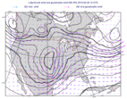
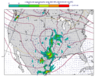
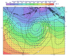
geostrophic_wind
- geostrophic_wind(z, coriolis=None)
Computes the geostrophic wind from geopotential on pressure levels.
- Parameters
z – input fieldset (geopotential on pressure levels)
coriolis (number or None) – set a constant Coriolis parameter value (1/s) for the computations. If it is None (the default) the real Coriolis parameter is computed for each gridpoint.
- Return type
For a given z geopotential field the computation of the geostrophic wind components is based on the following formulas:
\[ \begin{align}\begin{aligned}u_g = -\frac{1}{f} \frac{1}{R}\frac{\partial z}{\partial \phi}\\v_g = \frac{1}{f} \frac{1}{R \ cos\phi}\frac{\partial z}{\partial \lambda}\end{aligned}\end{align} \]where:
R is the radius of the Earth
\(\phi\) is the latitude
\(\lambda\) is the longitude.
\(f=2\Omega sin\phi\) is the Coriolis parameter, where \(\Omega\) is the Earth’s angular velocity. When
coriolisis set a constant value is used for f.
The derivatives are computed with a second order finite-difference approximation. The resulting fieldset contains two fields for each input field: the u and v geostrophic wind components. In each output field the points close to the poles and the Equator are bitmapped (they contain missing values).
Warning
geostrophic_wind()is only implemented for regular latitude-longitude grids.Note
See also
q_vector().


