mvl_geocircle
- mvl_geocircle(lat, lon, radius, resolution)
Plots a circle defined on Earth’s surface with a given radius in km onto a map in any projections. It is possible to split the circle into disk sectors with different radii.
- Parameters
lat (number) – latitude of the centre of the circle
lon (number) – longitude of the centre of the circle
radius (number or list) – radius of the circle in km; or a list with the radii of the disk sectors the circle is split into
resolution (number) – number of line segments to make up the circle
- Return type
Internally, the circle is split into
resolutionnumber of segments and the returned result is aninput_visualiser()object which can be passed toplot()along with an optionalmgraph()object.When
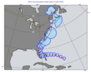
radiusis a list each item in the list defines a radius for a disk sector. E.g. when the list contains four items they define the quadrants the circle is to split into (see the Storm Wind Quadrants example).