Part 5 - NetCDF
Note
NetCDF data is represented by the NetCDF object in Metview.
Setup
Navigate into the 4_netcdf folder within Metview where you will find some data files and other icons.
Examine and visualise a geomatrix style netCDF file
Right-click on the file era5_2000_aug.nc and choose examine to see the structure of the file:
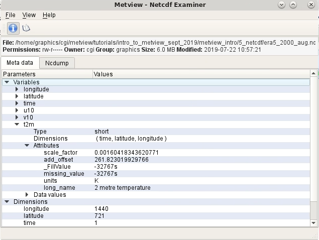
For more complete information, click on the NcDump tab.
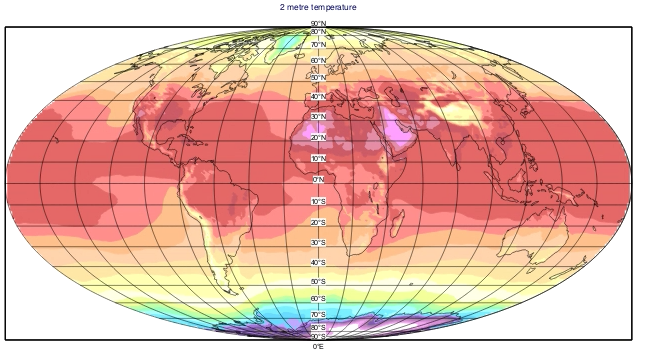
You will need to tell Metview how to visualise this data, as there are multiple variables. Create a new NetCDF Visualiser icon, edit it and set the following parameters:
Parameter |
Value |
Netcdf Data |
Drop the era5_2000_aug.nc icon into this box |
Netcdf Plot Type |
Geomatrix |
Netcdf Latitude Variable |
latitude |
Netcdf Longitude Variable |
longitude |
Netcdf Value Variable |
t2m |
Save the icon and visualise it. For fun, drop the supplied icons contour_t2m and mollweide into the plot window to obtain the following:
Examine and visualise a geopoints style netCDF file
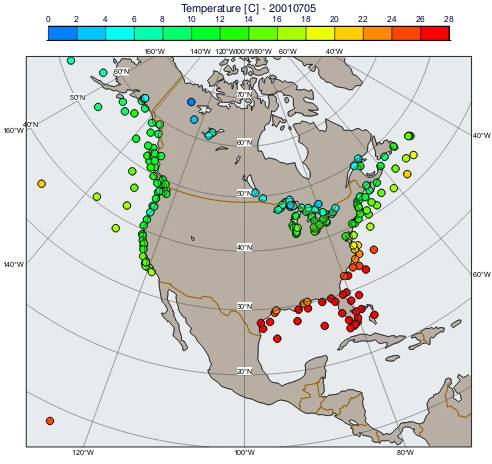
Examine the file madis-maritime.nc. We will plot the temperature variable. As you can see, there are 1-dimensional variables for temperature, latitude, and longitude. Create a copy of your previous NetCDF Visualiser icon and edit it as follows:
Parameter |
Value |
Netcdf Data |
Right-click/remove the existing netCDF file from there, then drop madis-maritime.nc into this box |
Netcdf Plot Type |
Geo Points |
Netcdf Latitude Variable |
latitude |
Netcdf Longitude Variable |
longitude |
Netcdf Value Variable |
temperature |
Visualise it to get a default plot.
In the solutions folder is a script called gallery_example_nc_maritime_obs.py, which converts from Kelvin to Celcius and adds some stying to the plot (generated as PDF - simply remove the setoutput() command to get an on-screen visualisation).
Extract data and convert to pandas
Have a look in the solutions folder and edit and run the script netcdf_to_pandas.py. This shows how to extract some metadata from the previous netCDF file, and also some value arrays and convert into a pandas dataframe. The code is also here:
import metview as mv
import pandas as pd

nc = mv.read("madis-maritime.nc")

# print some global fields
print('Variables: \n', nc.variables())
print('Global attributes: \n', nc.global_attributes())

# extract certain variables - setcurrent() followed by values()
nc.setcurrent('latitude')
lats = nc.values()
nc.setcurrent('longitude')
lons = nc.values()
nc.setcurrent('temperature')
temps = nc.values()
print('temperature attributes: \n', nc.attributes())

# create a dictionary in order to convert to pandas
pddict = {'latitude'    : lats,
          'longitude'   : lons,
          'temperature' : temps}

df = pd.DataFrame(pddict)
print('Dataframe: \n', df)
print('temperature describe: \n', df.temperature.describe())